
Table of Contents
- How Bend’s Four Quadrants Shape Neighborhood Choice
- Cost of Living in Bend: What Buyers Should Budget For
- Walkable Neighborhoods in Bend and Car-Light Living
- Real Estate Market Trends and Neighborhood Price Ranges
- Schools, Commutes, and Family-Friendly Districts
- Moving to Bend Oregon Checklist for Out-of-State Buyers
- Micro-Climates, Transit, and Remote Work Infrastructure
- Frequently Asked Questions
Last Updated: September 12, 2026
How Bend’s Four Quadrants Shape Neighborhood Choice
Finding the best neighborhoods in Bend Oregon starts with one thing: this city thinks in quadrants. Locals divide Bend into four sections (northwest, northeast, southeast, and southwest), and that mental map shapes everything from commute times to price per square foot. At I Sell Bend Oregon, we’ve watched out-of-state buyers get confused by a listing’s address until they realize the quadrant tells them more than the street name ever will.
The dividing lines are simple: Highway 97 runs north to south, and the Bend Parkway splits east from west. Where a home sits relative to those two roads determines its elevation, tree cover, and often its price.
Westside: Established Charm and Mountain Views
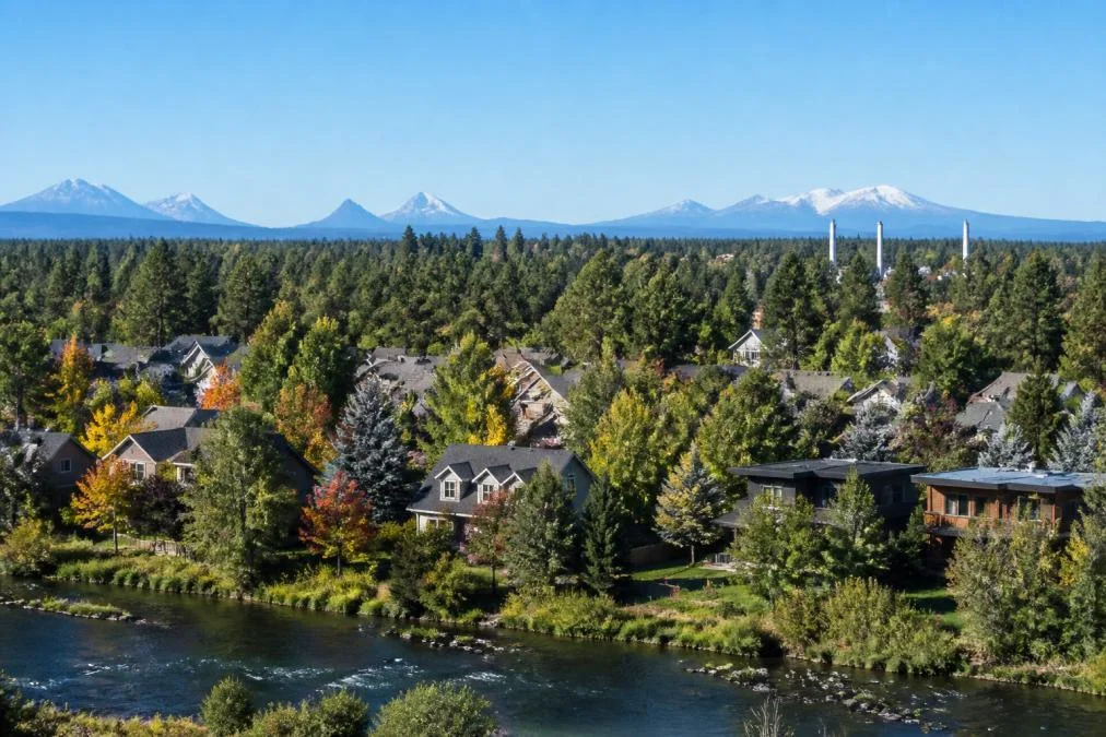
The westside carries the highest elevation and the oldest housing stock. Streets wind through mature ponderosa pine, and many lots back onto the Deschutes River corridor or the trail system. Homes near Drake Park sit within walking distance of downtown, which keeps demand steady. The trade-off is price: inventory is limited, so move quickly when the right house appears.
Eastside: Newer Builds and More Space
East of the Parkway, Bend opens up: wider lots, newer construction, and more square footage for the same budget. The northeast side sits closer to the Bend Municipal Airport and the Forum shopping area, while the southeast pushes toward Pilot Butte and the expanding eastside commercial corridor. Families often land here because inventory is deeper and streets are quieter. The drawback: “close to downtown” becomes a drive rather than a stroll.
North and South: Suburban Growth and Trail Access
North Bend and the southern edges absorb most new construction. The north side feeds the Redmond commute and offers quick access to Smith Rock, while the south side sits near the Cascade Lakes Highway and famous trailheads. Both trade walkability for trail access and newer infrastructure, and deliver the most house for the money for remote workers or Redmond commuters.
Cost of Living in Bend: What Buyers Should Budget For
The cost of living in Bend runs above the national average, and housing drives most of that gap. Buyers from larger metros often find Bend competitive; buyers from smaller inland cities find it a stretch.
Beyond the mortgage, budget for these recurring costs:
- Property taxes, which vary by Deschutes County assessment and neighborhood
- Homeowners insurance, higher in wildfire-risk zones on the city’s western and southern edges
- Utilities, including higher winter heating bills at elevation
- Water and sewer through the city, plus irrigation charges in some districts
Qualified buyers should get a full cost-of-living picture before making an offer, not after. A house that looks affordable on the listing page can carry a very different monthly number once taxes and insurance land. For current figures, check the U.S. Bureau of Labor Statistics Consumer Expenditure Survey for regional spending benchmarks, and ask a lender for a full payment breakdown rather than a mortgage estimate alone.
Walkable Neighborhoods in Bend and Car-Light Living
Walkable neighborhoods in Bend cluster around the westside and the downtown core, but “walkable” is a spectrum here, not a binary. The U.S. Department of Transportation notes that walkable areas typically command higher property values, and Bend follows that pattern, but the premium only holds on blocks that are genuinely pedestrian-connected, not just blocks that sit inside a walkable ZIP code.
What separates a car-light Bend address from a car-dependent one comes down to three things: whether you can reach a grocery store on foot, whether a low-stress bike route connects you to the core, and whether a Cascades East Transit bus line runs within a few blocks. Most guides stop at Walk Score, that number alone will mislead you.
The corridors that actually support car-light living
- Downtown core (Wall Street, Bond Street, Minnesota Avenue), Highest walkability in the city. Dining, the Saturday farmers market, the library, and medical offices are all within a short walk. Trade-off: event-night noise, paid parking, and older buildings with fewer garages.
- Drake Park and the river corridor, River trails, coffee shops, and a straight walk into downtown via the Galveston Avenue bridge. Trade-off: the highest price per square foot in the city and limited inventory.
- Galveston Avenue corridor, A compact strip of local retail and restaurants that functions as a walkable neighborhood center for the westside. Trade-off: smaller lots and older housing stock.
- Northwest Crossing, A planned neighborhood on the westside with an internal trail network and a small commercial core. Trade-off: it sits farther from downtown, so a bike or bus is usually part of the plan.
- Eastside near the Forum shopping area, Groceries and big-box retail are walkable, but the blocks between them are wide and car-oriented. A car stays in the picture.
- North and south edges, Trail access is excellent; daily errands are not. Expect to drive for almost everything.
Biking and transit: the part most guides skip
Bend’s bike network is strongest on the westside and through the core, where the Deschutes River Trail and paved river connections give riders a low-stress spine that avoids Highway 97 and the Parkway. East of the Parkway, bike infrastructure is fragmented, and crossing the Parkway is the biggest barrier to a car-light eastside life, riders route through a few crossings, concentrating traffic and raising stress.
Cascades East Transit runs fixed bus routes through Bend, heaviest in the core and along major arterials. Coverage thins quickly outside those corridors, and many north and south edge neighborhoods have limited or no service. To drop to one vehicle, the practical test is whether a bus stop sits within a short walk of home and whether that route reaches your workplace without a transfer.
How to test a neighborhood before you commit
- Pull up the address on a bike-route map and trace your actual commute, not a hypothetical one.
- Check whether a Cascades East Transit stop is within a few blocks and whether the route runs on weekends.
- Walk the block at rush hour, a street that feels calm at noon can be a cut-through at 5 p.m.
- Confirm the nearest full-service grocery store, not just a convenience store.
- Ask whether the home has secure bike storage; in Bend, that matters more than a second parking space for many buyers.
A common mistake is assuming “walkable” means “no car needed.” In Bend, only the core and parts of the westside let you genuinely drop to one vehicle. Everywhere else, a car stays part of the plan, budget for that reality instead of fighting it.
Pro Tip
Before you tour, open a bike-route map and a Cascades East Transit route map side by side. If neither shows a low-stress connection to your daily destinations, treat the home as car-dependent no matter what the Walk Score says.
Before you tour, open a bike-route map and a Cascades East Transit route map side by side. If neither shows a low-stress connection to your daily destinations, treat the home as car-dependent no matter what the Walk Score says.
Real Estate Market Trends and Neighborhood Price Ranges
Bend’s real estate market rewards patience and penalizes hesitation. Housing inventory remains tighter than many comparable western cities, and well-priced homes in desirable quadrants still draw multiple offers.
What most guides miss is how much price varies within a single quadrant. Two homes a mile apart can differ sharply because of elevation, school catchment, and whether the lot backs onto a trail or a busy road.
Watch these signals when you’re evaluating a neighborhood:
- Days on market for comparable homes in the same school catchment
- Whether listings are reducing price or selling above asking
- New construction permits, which signal where infrastructure is heading
- Rental demand, useful if you’re weighing a duplex or rental home as an investment
For broader market context, the Federal Reserve Economic Data on housing tracks national trends that influence local lending costs.
Watch Out
Shopping by quadrant alone is the most common buying mistake we see. A home on the wrong side of a school boundary or a floodplain line can cost you resale value years later. Verify the exact parcel, not just the neighborhood name.
Shopping by quadrant alone is the most common buying mistake we see. A home on the wrong side of a school boundary or a floodplain line can cost you resale value years later. Verify the exact parcel, not just the neighborhood name.
Schools, Commutes, and Family-Friendly Districts
Family-friendly neighborhoods in Bend tie directly to school catchment boundaries. Bend-La Pine Schools serves the city, and homes inside a sought-after catchment often sell faster and hold value better than comparable homes just outside it.
Commute times shift by quadrant. Downtown to the north side runs against traffic in the morning; westside to eastside crosses the Parkway, which slows at peak hours. Buyers working in Redmond should weight the north side heavily, the drive up Highway 97 is straightforward and predictable.
For families, the practical checklist looks like this:
- Confirm the school boundary for the specific address, not the subdivision
- Drive the commute at the actual time you’d travel it
- Check park and trail access within walking distance
- Look at the age mix on the street, which tells you about long-term stability
A neighborhood that fits one family’s routine can be a poor fit for another. Test the daily logistics before you fall in love with a floor plan.
Moving to Bend Oregon Checklist for Out-of-State Buyers
A moving to Bend Oregon checklist keeps a cross-country relocation from turning into guesswork. Out-of-state buyers face a specific challenge: you can’t easily visit twice, and the market moves faster than a weekend trip allows.
Work through these steps in order:
- Get pre-approved with a lender licensed in Oregon before you shop
- Decide your quadrant priorities: walkability, trail access, schools, or space
- Schedule a focused tour block rather than scattered showings
- Verify school catchment, floodplain, and wildfire zone for any finalist
- Budget for insurance and taxes, not just the mortgage
- Line up a local inspector who knows Central Oregon construction
- Plan your closing timeline around your move date, not the other way around
Remote buyers can lean on video walkthroughs and local representation to stay competitive. The Consumer Financial Protection Bureau offers a useful guide to shopping for a mortgage and understanding closing costs before you commit.
Pro Tip
Book your tour block for a weekday, not a weekend. You’ll see real commute traffic, real school drop-off congestion, and real noise levels. A Saturday visit hides all three.
Book your tour block for a weekday, not a weekend. You’ll see real commute traffic, real school drop-off congestion, and real noise levels. A Saturday visit hides all three.
Micro-Climates, Transit, and Remote Work Infrastructure
This is the section most Bend neighborhood guides skip, and it’s the one that most often decides whether a buyer is happy two winters in. Bend’s elevation changes are modest in absolute terms, but they produce noticeably different snow, sun, and wind exposure block to block, and that shows up in your driveway, heating bill, and commute.
Micro-climates: how elevation and terrain split the city
Bend sits at roughly 3,600 feet, and the westside climbs above that toward the foothills. The practical effects:
- Westside (higher elevation, more tree canopy), Cooler overall, more snow accumulation, and later spring melt. Shaded streets under mature ponderosa pine can hold ice longer than sun-exposed eastside blocks. If you dislike shoveling or driving on packed snow, this matters.
- Eastside and north side (lower, more open), Warmer and drier, with more sun exposure and faster snow melt. Wind can be more noticeable where the terrain opens up.
- South side (closer to the Cascades), Catches more weather moving off the mountains, so storm totals can run higher than the city core during a single event.
- River corridor and low-lying areas, Cold air drains into low spots overnight, which can mean colder mornings and more frost than surrounding higher ground.
The takeaway isn’t that one micro-climate is better, it’s that two homes twenty minutes apart can feel like different seasons. Buyers who want a shorter snow season gravitate east; buyers who want shade and cooler summers gravitate west.
Transit: what’s realistic without a car
Cascades East Transit provides fixed-route bus service in Bend, densest in the core and along major arterials. Outside those corridors, coverage thins, headways lengthen, and weekend service is limited. For most households, transit supplements a car rather than replacing it, except in the core and parts of the westside, where a one-car household is genuinely workable.
If transit access is a priority, verify three things for any address: the distance to the nearest stop, whether the route reaches your destination without a transfer, and whether it runs on the days and hours you actually travel.
Remote work infrastructure: verify before you offer
Bend has become a remote-work hub, making internet service a first-order question rather than an afterthought. Service quality varies by street, and the difference between a fiber-connected block and one served only by older technology is significant for anyone running video calls, large file transfers, or a home-based business.
Before making an offer on a home where you’ll work remotely:
- Enter the specific address into the major providers’ availability tools, availability is address-level, not neighborhood-level.
- Ask the seller or listing agent which provider and plan the home currently uses, and whether the connection is fiber, cable, or fixed wireless.
- Confirm upload speed separately from download speed; upload is what breaks video calls.
- Ask about a backup option, a second provider or a mobile hotspot, since outages happen.
- If the home is on the edge of the city or in a rural-adjacent pocket, treat connectivity as a contingency you resolve before closing, not after.
Noise and flight paths
Noise never shows up in listing photos. Homes near the Parkway and Highway 97 carry continuous traffic hum that rises at commute hours. Homes under the municipal airport’s flight paths get intermittent but noticeable overflight noise, especially early morning and evening. Major arterials cut through otherwise quiet neighborhoods and can turn a calm street into a cut-through at peak times.
The fix is simple and cheap: visit the property at more than one time of day. A weekday morning and a weekday evening will tell you more about noise than any map.
Key Takeaway
The single most overlooked factor in Bend is micro-climate, followed closely by address-level internet service. A westside home and an eastside home can differ by weeks of snow cover each winter, and two homes on the same street can have different internet providers. Match the climate and the connectivity to your lifestyle, not just the house.
The single most overlooked factor in Bend is micro-climate, followed closely by address-level internet service. A westside home and an eastside home can differ by weeks of snow cover each winter, and two homes on the same street can have different internet providers. Match the climate and the connectivity to your lifestyle, not just the house.
Frequently Asked Questions
What is the nicest part of Bend, Oregon?
The Westside draws the most praise for its historic district, mature trees, and mountain views, while Northwest Crossing offers newer homes with a walkable town center. Neither is objectively ‘nicest’ for everyone. Buyers who value trail access lean toward the west side of the Deschutes River, and those who want more square footage for the money often prefer eastside neighborhoods. The right fit depends on your commute, budget, and whether you want a historic home or a newer build.
Which neighborhoods in Bend offer the best walkability?
Downtown Bend and the Old Mill District score highest for walking, with restaurants, shops, and the river trail within a few blocks. Northwest Crossing is another strong option because it was designed with a walkable town center, schools, and parks inside the neighborhood. Walkable neighborhoods in Bend tend to cost more per square foot, so buyers should weigh the premium against how often they will actually leave the car at home.
How do housing prices compare across Bend’s quadrants?
Westside and downtown-adjacent homes carry the highest price tags, driven by older architecture, river proximity, and limited inventory. The eastside and outer north and south areas generally list lower for the same square footage, though new construction can close that gap. Median home price varies block by block, so it helps to compare recent sales within a specific neighborhood rather than rely on a citywide average. A local agent can pull current numbers for the streets you are targeting.
What should I know before moving to Bend from out of state?
Start with the moving to Bend Oregon checklist: confirm your budget against the cost of living in Bend, research school catchment boundaries if you have children, and test your commute at rush hour before you commit to a neighborhood. Bend’s micro-climates vary, so a neighborhood that stays sunny in winter may sit a few degrees warmer than one closer to the mountains. Internet connectivity also differs by street, which matters if you work remotely. A local walkthrough saves expensive surprises.